In the Heart of the Negev Desert: Part One of the Israel National Trail
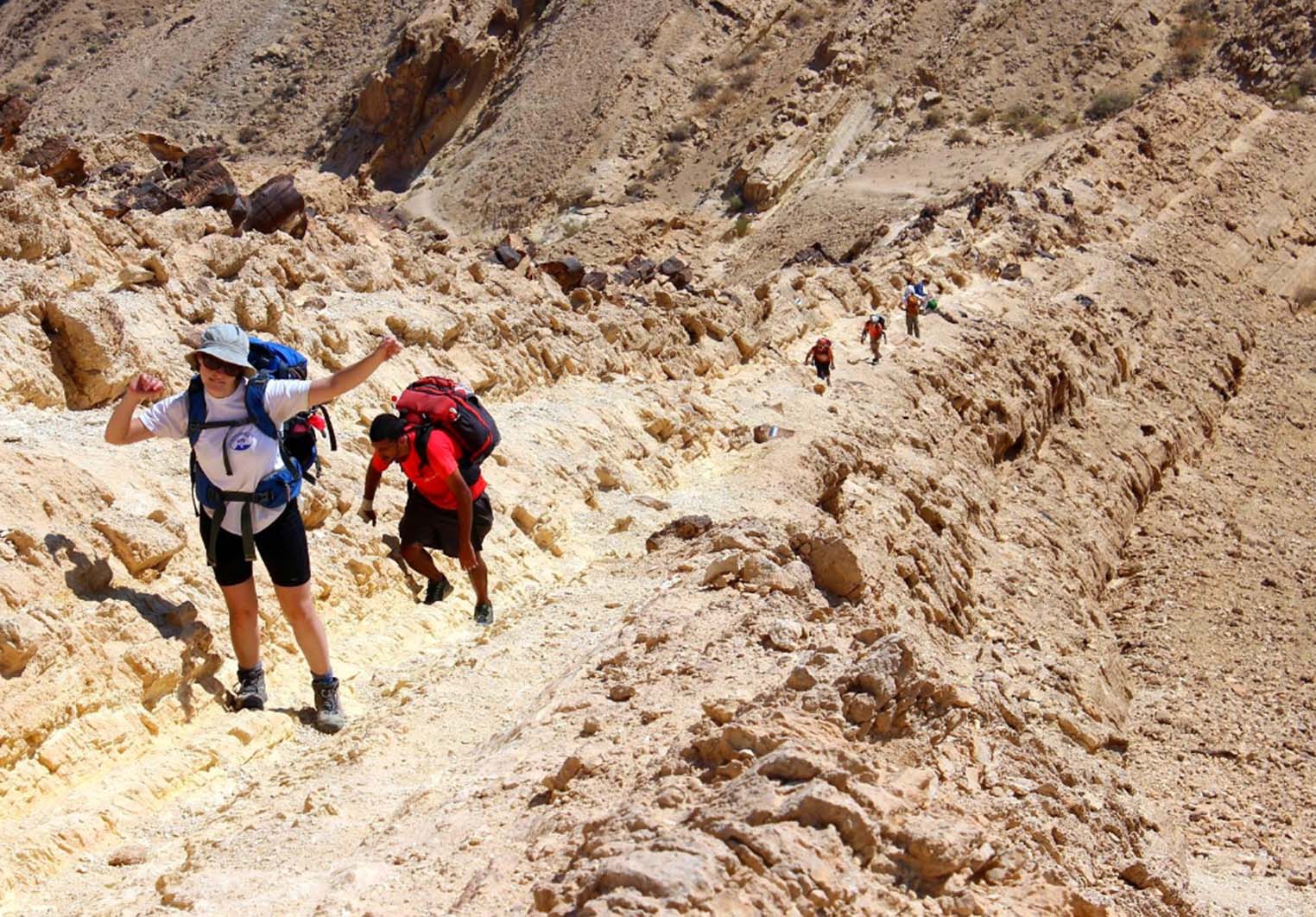
Sweat trickled down my forehead, legs, and belly, while it made its way down my elbows. I felt like I was on the verge of passing out. Here I was, in the center of the Negev Desert, about to trek under the scorching sun for another day and a half, with no shade in sight. I was on the brink of collapse, but I kept pushing forward, trying my best to avoid stumbling on a rock hidden beneath the sandy, gravel-covered desert floor.
The temperature soared to around 100°F/37°C, and the sun had reached its zenith. I turned around to gauge our progress – it felt like we had been walking for quite a while since the minibus dropped our group of hikers off at a remote spot early that morning. The awe-inspiring desert landscape behind us made up for all the sweat and fatigue, reminding me that the strenuous trek was worth it.
In fact, we weren’t in a remote place, but rather in the middle of a small crater, known in Hebrew as ‘makhtesh.’ These unique craters are a distinctive feature of the Negev Desert, and they aren’t formed by meteor impacts but rather through erosion. Later that evening, as we finally climbed the steep side of the crater’s rocks, I would turn and wonder how nature could create such a perfectly round crater, resembling a meteor impact crater, when it had been shaped by something entirely different.
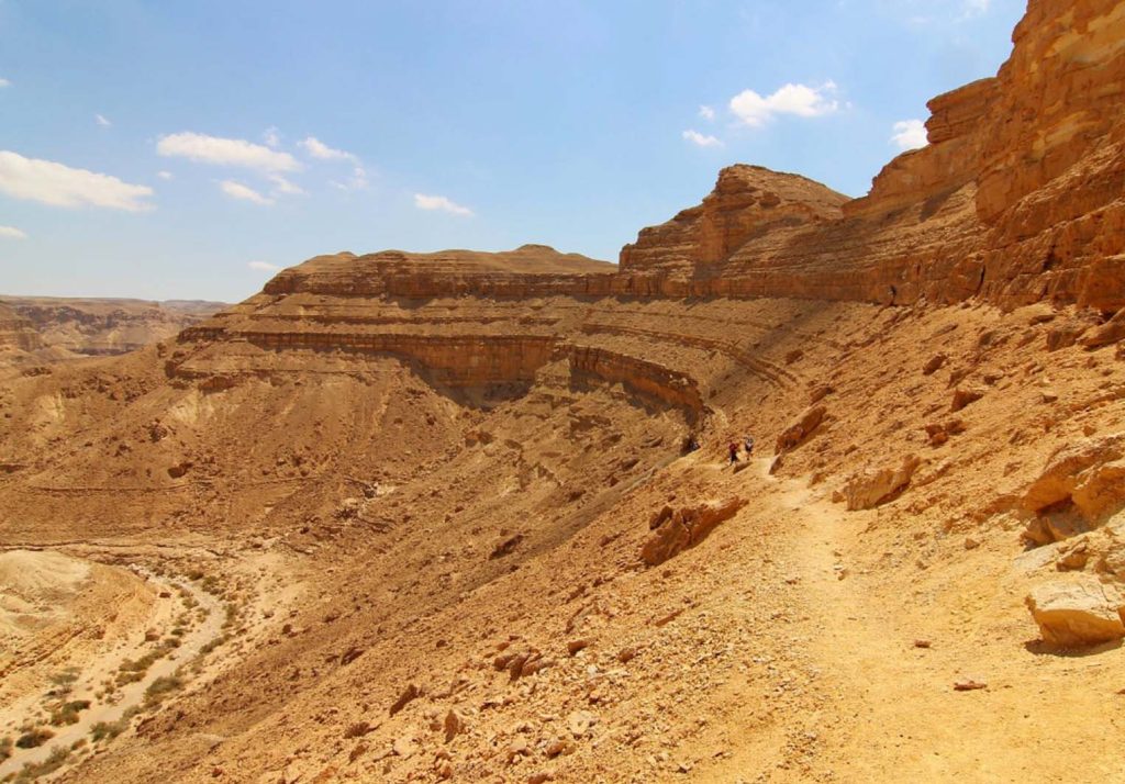
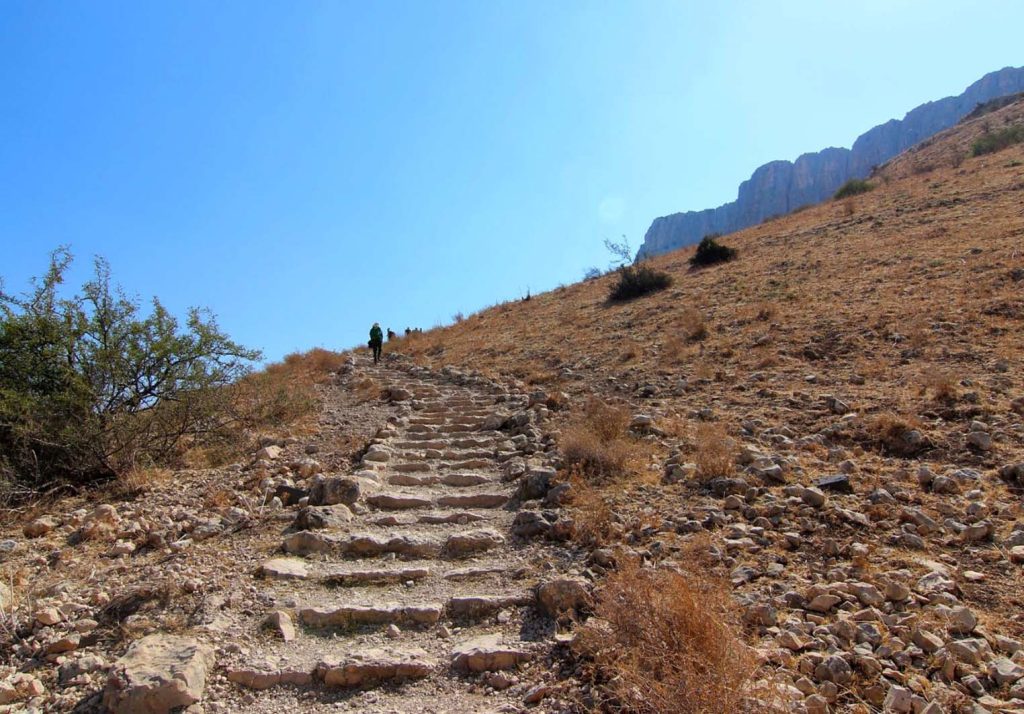
The first day in the desert proved to be the most challenging part of the entire hiking expedition. The scorching sun beat down on my face, making the sweltering weather even more taxing, and the final stretch of the hike took us up a steep, winding trail along the rim of a volcanic crater. It left me utterly exhausted, and I drifted off to sleep on a thin camping mattress at our temporary campsite before dinner.
I embarked on this journey to hike the Israel National Trail, a 1,000-kilometer/620-mile long hiking trail that spans the country from south to north, starting near the Red Sea in the south, close to the Jordanian border, and ending near the Lebanese border in the north.
The makhtesh crater walls in Katan served as a formidable obstacle. For those who enjoy multi-day hiking adventures, like the Camino de Santiago in Spain, the Appalachian Trail in the United States, or the Annapurna Circuit in Nepal, this hike is nothing short of an epic trek. While this trail has garnered praise from National Geographic and other renowned travel magazines, it has primarily been traversed by Israelis who aim to intimately explore their own country in a very special way.
This trail itself is far from being as famous as Turkey’s Camino de Santiago or the Lycian Way, but it is also far from being as ancient, even though it passes through countless historically significant places. It not only traverses locations steeped in historical and biblical significance but also showcases the diversity of this small country: from the Negev Desert in the south to the rolling hills around Jerusalem, Tel Aviv’s coastline, and the Galilee Mountains near the sea, all the way to the northernmost settlement of Israel, Dan in the Galilee.
Compared to the Camino de Santiago, a pilgrimage route traveled by people since the Middle Ages, this trail is still in its infancy, having been inaugurated only 20 years ago, in 1994. Completing the entire trail takes six to eight weeks, but we hiked only a portion of it. This included sections of the southern Negev Desert, the mountains around Jerusalem, and the lower Galilee region in northern Israel. With just eight days at our disposal, we got a taste of each area the INT traverses, leaving us craving to explore more.
For me, it was a perfect introduction to Israel, as I embarked on a month-long exploration of the country. When I later revisited familiar places in my hiking journey, it allowed me to appreciate the surroundings even more – just like the Negev. Once you spend time in this vast expanse of nothingness in the desert, walking for hours on barren land with almost no signs of life, you see it in a completely different way than when you drive through it.
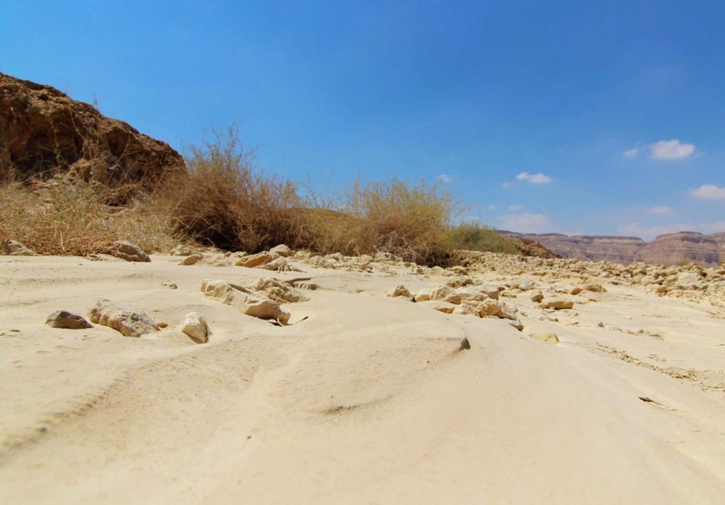
On the first day, we encountered very few trees, with little sign of life except for a few dusty shrubs. Often, it was challenging to discern any traces at all. However, some rocks bore periodic trail markers in the colors of the National Trail, indicating that you were still on the right path, as there were no other signs to rely on. Hiking through the Israeli Negev Desert that night, most of us chose to sleep under the starry sky, an unforgettable experience. Tents were optional; why obstruct such a magnificent view? Millions of stars illuminated the night sky. After a hearty dinner, I was fortunate to wake up, and we gathered around the campfire to better get to know each other. However, the wake-up call at 6 a.m. made me crawl into my sleeping bag.
Hiking through the Negev Desert in Israel, the landscape on the second day was quite different from the first. As we walked along a dry riverbed, we passed more trees and shrubs. In this country, rain in the winter days can lead to flash floods rushing through the riverbed, allowing vegetation to thrive in this otherwise barren area.
Although this hike felt less exhausting than the first day (partly because our bodies had become acclimated to walking in scorching weather), it remained highly challenging. At one point, we ascended a steep hill, requiring hooks and handrails to climb. However, the scenery and landscapes always made up for the most challenging parts of the hike. I relished the sense of accomplishment when I navigated particularly difficult stretches of the trail. After all, such hikes are about the journey itself, not just reaching the destination.
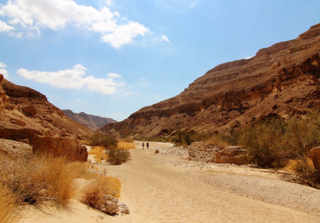
After enjoying a picnic lunch in a place that had provided water and shelter to countless travelers over thousands of years, we embarked on our final desert adventure: the Great Fin, or as I saw it, the incredibly steep walls of the largest makhtesh in the Negev, Israel’s Great Makhtesh.
I knew this would be today’s last significant challenge, so I pushed myself to climb the rocky slope under the merciless sun, testing my limits. Reaching the summit, the magnificent view once again compensated for the physical test of our hiking journey. We had to retrace our steps, with most of us having consumed the last drop of water from our bottles by then. Knowing that we had to ration our water reminded me that we were far from any settlements, and it would be a very tough journey if you were planning to do it solo.
Fortunately, hikers on the trail don’t have to rely solely on themselves. The Trail Angels provide a valuable support network, allowing hikers to sleep in their homes, take showers, or simply replenish their water supply. We didn’t camp under the stars again, but instead, hopped onto a minibus waiting for us, driving to Sde Boker, where we encountered some so-called “trail angels.” We were all warmly welcomed by incredibly hospitable families, and the first shower after spending two days in the desert felt truly glorious.
We knew it would be our last night in the arid Israeli desert. The next day, we would drive north to hike in the mountainous terrain around Jerusalem.
On the third day as we began our hike, the scenery was a stark contrast to the previous two days of desert trekking. Instead of the vast, reddish landscapes of the Negev Desert, we found ourselves in the lush green hills of the Judean Lowlands. Pine trees surrounding the Israeli trail emitted a captivating fragrance, and birds were chirping in the distance. There were few signs of life in the desert. We ascended Tel Azekah, a hill that overlooks the Jerusalem Mountains and the Elah Valley, where, according to the Bible, David once battled Goliath. The hill itself is known for its burial caves from various periods and secret tunnels from the time of the Bar Kokhba Revolt.
After a brief introduction to the area and the events that led to David defeating Goliath, we temporarily halted our natural hiking and proceeded to visit the capital of Israel, Jerusalem, arguably one of the world’s most significant religious cities.
Next, we continued our hike on the Shvil Israel (Hebrew for the Israel Trail) in the northern Galilee region of Israel and climbed Mount Tabor, also known as the Mount of Transfiguration. Mount Tabor is a standalone peak that rises majestically from the surrounding plains. It is famous for the Franciscan Church of the Transfiguration located on its summit, which you’ve probably guessed is the site of the Transfiguration of Jesus.
Looking down at the green fields below the mountain, it felt surreal that just a few days ago, we were trekking through the desert. One thing I appreciate about Israel is its diversity in landscapes. Despite being a small country (8,522 square miles – smaller than the U.S. state of Maine or one-sixteenth the size of Germany), its landscapes are more varied than many larger nations I’ve visited.
Walking the full 620 miles (1,000 kilometers) of the Israel Trail is a formidable undertaking, but it’s possible to complete independently with the right planning. In my view, the most challenging and awe-inspiring part of the trail is the stretch through the Negev Desert, where settlements are sparse, and water is hard to come by. Most hikers either cache supplies in commonly used storage rooms or arrange for people to meet them and provide water and food (more information on how to prepare for the INT hike is provided below).
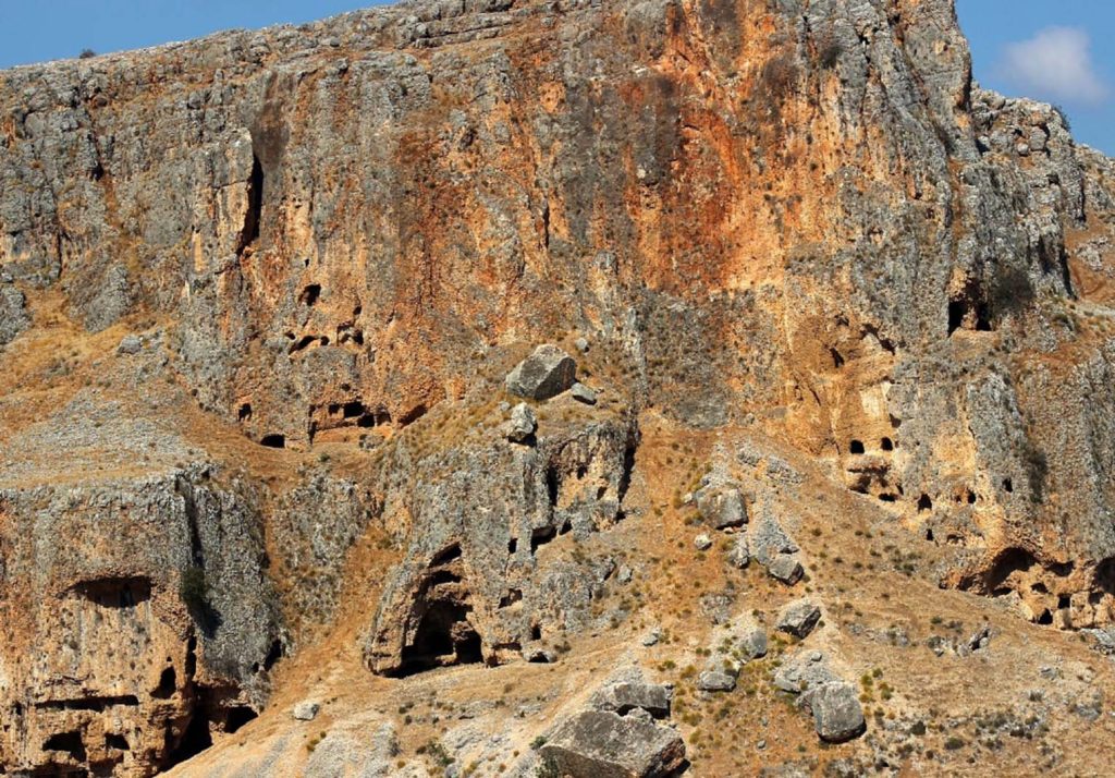
Our final major task was conquering Abel Mountain, where you can still see (and enter) dozens of caves that were inhabited by Druze settlers three centuries ago. These cliff dwellings reminded me of the cliff dwellings I visited in New Mexico last year, and it was astonishing how similar the lifestyles of settlers in North America and Israel could be, despite being thousands of miles and an ocean apart.
As we reached the mountaintop, we were greeted by an expansive view of the Sea of Galilee, where many of Jesus’ miracles occurred, including his walking on water and calming the storm. We enjoyed a coffee break on the steep cliffs (1,250 feet/380 meters high) and gazed upon Arab villages, date palm groves, and avocado orchards in the northern part of Israel. We could even see the mountain range of the Golan Heights in the distance, extending into Syria. Once again, I was amazed by the inherent natural diversity of this small nation.
The Israel Trail is nearly as diverse in its landscapes as the communities that inhabit this land. It passes through Arab and Jewish settlements, sometimes villages where both reside. It traverses Christian, Baha’i, and Druze communities. We were fortunate to be invited into a Druze family’s home in the Lower Galilee, where we enjoyed some of the best food I had during my time in Israel. It also gave us a deeper understanding of this lesser-known religion. Learning about their beliefs, traditions, and history firsthand was truly fascinating, and the people you meet along the INT are undoubtedly an integral part of the whole experience.
After this hike, we all felt we deserved our final stop on the journey: the Jordan River. It’s the place where Jesus was baptized by John the Baptist. However, when we arrived, the biblical aspects were far from our minds. A chilled beer, a refreshing swim, and a free foot spa courtesy of hundreds of little fish eagerly nibbling on our skin while we relished the sensation of taking off our hiking boots – it was the perfect way to conclude our long journey.
On one hand, the challenging hike had come to an end, and I could savor the city life in Tel Aviv, which was a welcome change. However, I felt that there was so much more to explore on the Israel Trail. The part I walked was just a teaser of the entire route, sparking my interest in other sections. But there’s no better way to get to know Israel than a week on the INT. I hope to return one day to complete the entire trail.
